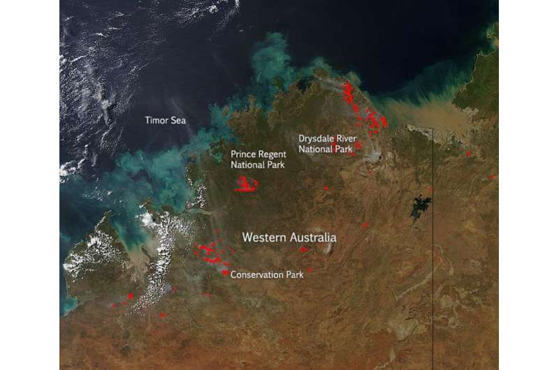
NASA image: Fires in Western Australia April 2015

Bushfires are inevitable in the fire-prone landscapes of Western Australia. Long dry summers, vegetation and undergrowth, and ignition from lightning or human causes mean that bushfires can and do occur every summer.
A bushfire is an unplanned fire (in the U.S. this is referred to as a wildfire). Each year Australia's Department of Parks and Wildlife responds to more than 600 bushfires that occur on or near land managed by the department. Bushfires have many causes, some natural such as lightning and some as a result of human activity such as camp fires, escapes from prescribed burning operations, industrial activity such as timber harvesting, mining, farming and power transmission, and some from deliberate arson.
The fires which are indicated by red spots on this satellite image may be bushfires. These are areas where the thermal detectors on the MODIS instrument recognized temperatures higher than background. When accompanied by plumes of smoke, as in this image, such hot spots are diagnostic for fire.The Sentinel hotspot locator on Geoscience Australia show that the fires on this image are up to 24 hours old.
This natural-color satellite image was collected by the Moderate Resolution Imaging Spectroradiometer (MODIS) aboard the Aqua satellite on April 09, 2015. Actively burning areas, detected by MODIS's thermal bands, are outlined in red.
Provided by NASA's Goddard Space Flight Center


